Every municipality has its own unique challenges, but when it comes to transportation, there are a few common macro-level issues: some rail and bus infrastructure is perpetually overloaded or underutilized, while other neighborhoods lack transit or have very limited service. Meanwhile, traffic congestion and vehicle emissions continue to grow, and a personal vehicle is an expensive necessity in all but a few places, rather than a choice.
In an effort to solve these challenges, city leaders and public transit agencies are partnering with mobility technology companies and microtransit developers to help eliminate transit gaps and areas with limited or no coverage, create first- and last-mile connections to transportation hubs, and provide more convenient paratransit services — all while reducing the number of privately driven vehicles on the roads.
Microtransit is designed to complement and augment the transit backbone of cities, allowing transit authorities and cities to provide flexible and convenient transportation without investing in expensive new infrastructure. By providing access to stations and destinations for people who couldn’t or wouldn’t have used existing public transportation, microtransit helps people around the world access jobs, education, healthcare, local businesses, and social activities.
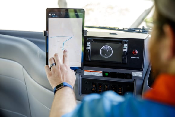
But a microtransit partnership has uses that extend beyond just the service itself. Arguably, one of the most valuable aspects of a microtransit partnership comes from something less tangible than a bus or shuttle: the data that microtransit companies collect about every ride.
9 Ways To Use Microtransit Data
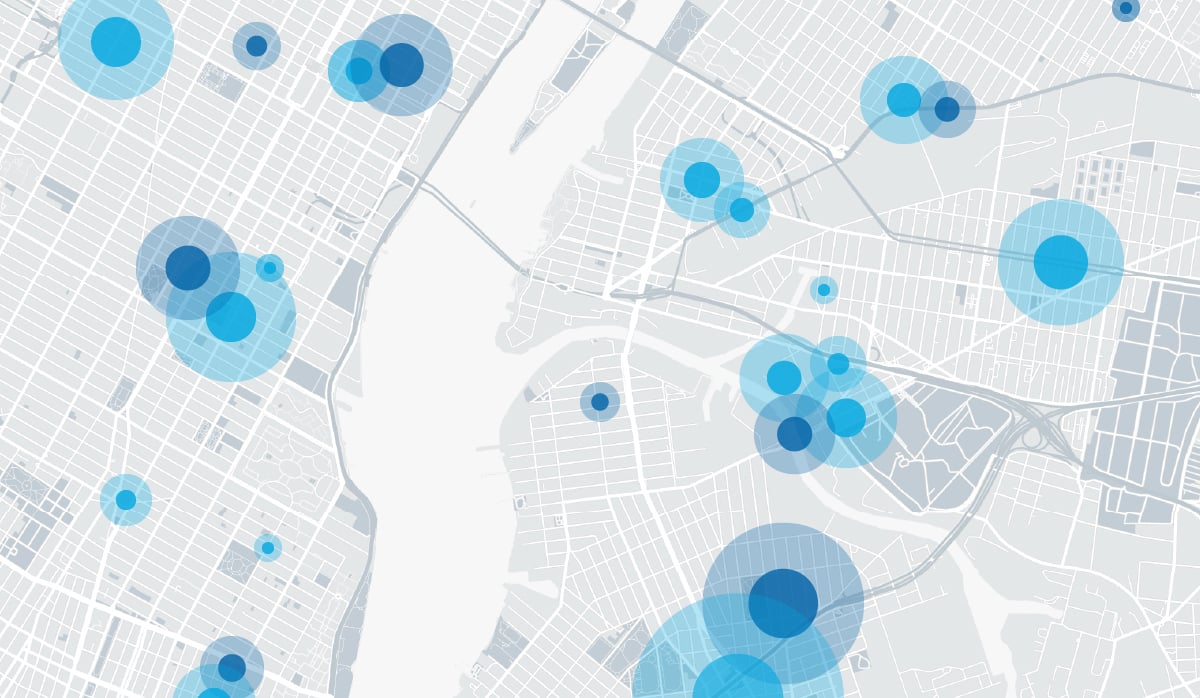
While the data that comes from microtransit services should always be scrubbed and anonymized to help protect individuals’ privacy, it does reveal important information like the approximate locations of where people are being picked up and dropped off, travel times, overall demand, and the level of demand from transit riders with special needs or disabilities.
These data have a wide variety of potential applications, allowing city leaders and transit agencies to:
1. Create Transit Equity
Microtransit data has an important opportunity to create transit equity in lower-income neighborhoods or public transit deserts. If data reveal that many riders in a certain area are using a first- and last-mile service to get to a bus or rail station, a transit agency can offer new incentives to further transit use, implement a new fixed bus route, or even investigate building new rail infrastructure.
2. Enhance Fixed-Route Transit
On-demand transportation networks often interact with and help support existing train and bus lines, meaning ridership statistics should help cities and transit agencies load-balance fixed-route bus services. If microtransit data indicates riders are using microtransit instead of buses because buses are at capacity, or not coming frequently enough, transit agencies can add additional buses to the same route or adjust timing to accommodate more passengers. On-demand vehicles can then be automatically rebalanced throughout the microtransit zone based on demand.
3. Improve Existing Infrastructure
Because on-demand transportation is designed to complement and augment the transit backbone of cities, it makes sense that resulting rider data can inform upgrades to existing transit infrastructure. Similarly to using the data to improve bus services, microstransit data that shows a particular station being a popular dropoff/pickup destination can help city planners prioritize station upgrades.
4. Make Transportation More Accessible
Using traditional public transportation is often times incredibly difficult or outright impossible for constituents with mobility issues like seniors and those with disabilities. Bus stops are generally prohibitively far from home, and some cities with older rail and subway lines do not have elevators or escalators in every station, meaning riders who cannot climb stairs must travel to a station that is more accessible. Knowing how many riders with mobility issues use microstranit service to get to an accessible station or their final destinations can help prioritize plans to improve accessibility at nearby transit hubs.
5. Take a Bite Out of Congestion
Traffic studies combined with microstransit data will indicate problem spots within a city, allowing city planners to reconfigure traffic flows and reduce congestion. Say the data shows a microstransit vehicle that always gets stuck at the same intersection for multiple traffic light cycles because the intersection’s stoplight lacks left-turn arrows. The city can deploy new traffic lights to keep traffic moving and reduce congestion — which helps not just microtransit vehicles, but also emergency vehicles, city buses, passenger vehicles, commercial trucks, taxis, etc.
6. Inform More Efficient Services
Operating a fleet of dynamically routed vehicles can actually help prioritize city services like plowing/salting and pothole repair. A robust microtransit network can reveal the most-used streets and indicating times of low traffic, so construction/weather mitigation efforts can help the greatest amount of people while affecting the fewest travelers.
7. Get the Word Out
Better target marketing for important city services. For example, many municipalities are advertising the 2020 census to solicit volunteers and ensure everyone gets counted. With microstransit data indicating hotspots where a lot of people frequently wait for a shared ride, cities can strategically place billboards or signage to gain visibility for their marketing efforts.
8. Focus On People, Not Cars
Cities should be designed for people, not their cars, which is why today’s urban planning experts are administering changes that make cities more livable. If data shows that people are leaving cars at home and using microtransit to travel to existing trains and buses, city planners can enhance neighborhoods with further transportation-oriented improvements like pedestrian malls, bike lanes and bike racks, walking paths, bus rapid transit, greenways and more — instead of building more parking lots or installing more parking meters.
9. Ask for More Data
Something else cities and transit agencies can do with microtransit data: Ask for more. Microtransit and mobility technology companies track a lot of data, but they can also push additional surveys to riders via a mobile app. If city planners are looking for anonymized data points related to transportation or other city services, it’s likely a microtransit partner can help.
How to Put Valuable Data to Work
It’s important to note that not every mobility technology company chooses to share their data. Some guard it closely in the name of protecting key business indicators like revenue, pricing models or demand from competitors, or in order to shield their actual environmental impact.
But those that choose to share data do so in the name of helping municipalities and transit agencies adjust their services and create a better place for everyone to live and work. By partnering with a company that agrees to share its data, transit authorities and city leaders can maximize the value of the microtransit service — because with so many ways to use the data, microtransit isn’t just a transportation improvement; it’s a way to improve the entire municipality.


